CHC Navigation launches the new version of CoPre Software

CHC Navigation launches the new version of CoPre LiDAR Processing Software, an even more powerful and intuitive software suite for seamless 3D LiDAR data and image processing.
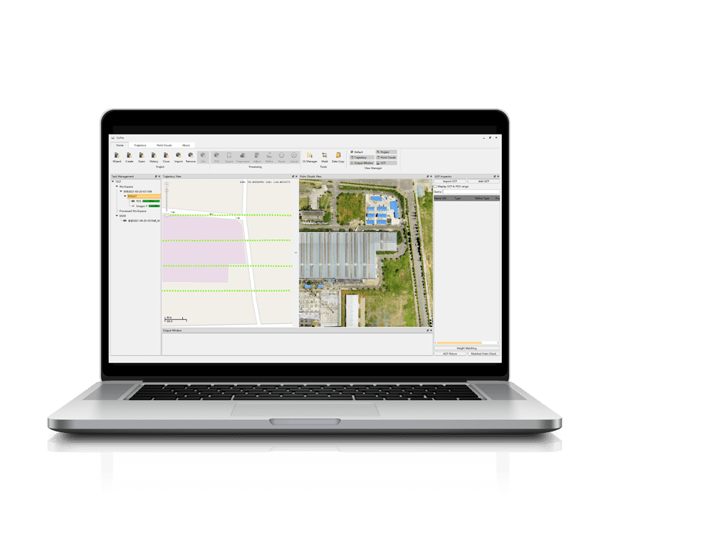
Shanghai, China – April 22, 2022 – CHC Navigation (CHCNAV) today released the new CoPre v2.4 LiDAR processing software, a powerful software ecosystem developed by CHCNAV allowing users to process mobile geospatial mapping data quickly and efficiently. CoPre features accurate trajectory processing through a proprietary algorithm, point cloud and image georeferencing, data adjustment for post-processing accuracy, point cloud colorization, filtering and digital ortho model (DOM) generation.
"3D reality capture professionals are increasingly adopting CHCNAV's LiDAR solutions from all over the world. To provide an enhanced user experience, our latest CoPre v2.4 release offers further features and a streamlined workflow for post-processing raw data from CHCNAV's LiDAR systems," said Andrei Gorb, Product Manager of CHC Navigation's Mapping and Geospatial Division. "Whether you want to process data from the airborne AlphaAir 450 LiDAR + RGB system, perform massive data processing from the vehicle-mounted Alpha3D, or get the results of the corridor mapping project with the AA2400 on a helicopter, CoPre will support all your mapping scenarios."
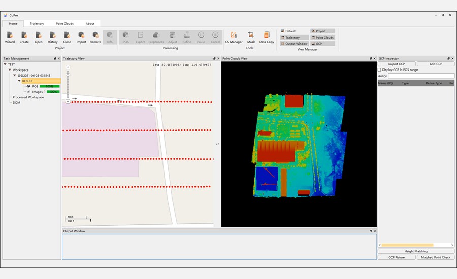
Figure 1. CoPre software: LiDAR scanner raw data processing.
POS PROCESSING
Powered by the accurate and efficient algorithm developed by CHCNAV, CoPre supports POS processing of vehicle-mounted, UAV, or airborne setups. Multiple data sets can be processed simultaneously to increase workflow efficiency.
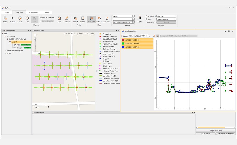
Figure 2. CoPre software: trajectory processing.
EXTREME DATA QUALITY
CoPre can handle the layering of multiple point clouds and improve relative accuracy with an efficient strip adjustment algorithm. Advanced calibration and optimization techniques result in point clouds that are up to 30% less thick than comparable products.
AUTOMATED PROCESSING
Automatic point cloud processing, image georeferencing, point cloud colorization, depth maps and results output are available in a single click.

Figure 3. CoPre software: point cloud processing.
EFFICIENT DATA ANALYSIS
CoPre includes various powerful options for analyzing data after processing steps. It supports the visualization of massive datasets with multiple colorization options. Automatic trajectory slicing and stratification checks can be performed, allowing quick detection of misalignment in the entire dataset.
The CoPre software is available worldwide today through the CHCNAV distribution network.
_____
About CHC Navigation
CHC Navigation (CHCNAV) creates innovative navigation and positioning solutions to make customers' work more efficient. CHCNAV products and solutions cover multiple industries such as geospatial, construction, agriculture and marine. With a presence across the globe, distributors in more than 120 countries and more than 1,500 employees, today CHC Navigation is recognized as one of the fastest-growing companies in geomatics technologies. For more information about CHC Navigation [Huace:300627.SZ], please visit: https://chcnav.com/about-us/overview
Know more about the CoPre software
Send an inquiry for the CoPre software
Send an inquiry to become a dealer for Mobile Mapping products