CHCNAV Introduces the i93 IMU-RTK GNSS receiver enhanced with the vision-based positioning

Shanghai, China - April 27, 2022 - CHC Navigation (CHCNAV) today announced the availability of the i93 Visual IMU-RTK GNSS smart antenna. The i93 is a versatile, high-end GNSS, IMU, and dual-camera receiver that pushes the boundaries of centimeter accuracy surveying. Its 3D visual staking feature offers unmatched ease of use and convenience, increasing operators' efficiency on any job site, regardless of their experience level.
"The innovative visual positioning simplifies point measurement and facilitates surveying in hard-to-reach or hazardous areas," said Rachel Wang, Product Manager of CHCNAV's Surveying and Engineering Division. "In addition, the i93 can be used to augment aerial surveys generated from oblique imagery with ground-based images, as its data is fully compatible with the most popular 3D modeling software. The i93 takes GNSS surveying to the next level by merging the best of GNSS, IMU, and 3D imaging into a single antenna."

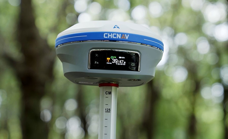
Figure 1. The i93 Visual IMU-RTK GNSS smart antenna with the premium dual camera and video-photogrammetry technologies.
- Boosts survey-grade GNSS RTK performance by 15%
The i93 GNSS receiver combines CHCNAV's proprietary iStar technology with an integrated 1408-channel RF-SoC processor for optimized use of all GNSS constellations and frequencies. These new technologies improve GNSS data quality and tracking capabilities by more than 20 percent, enhancing GNSS RTK performance in challenging environments. As a result, reliable and accurate positioning data is guaranteed for all applications.

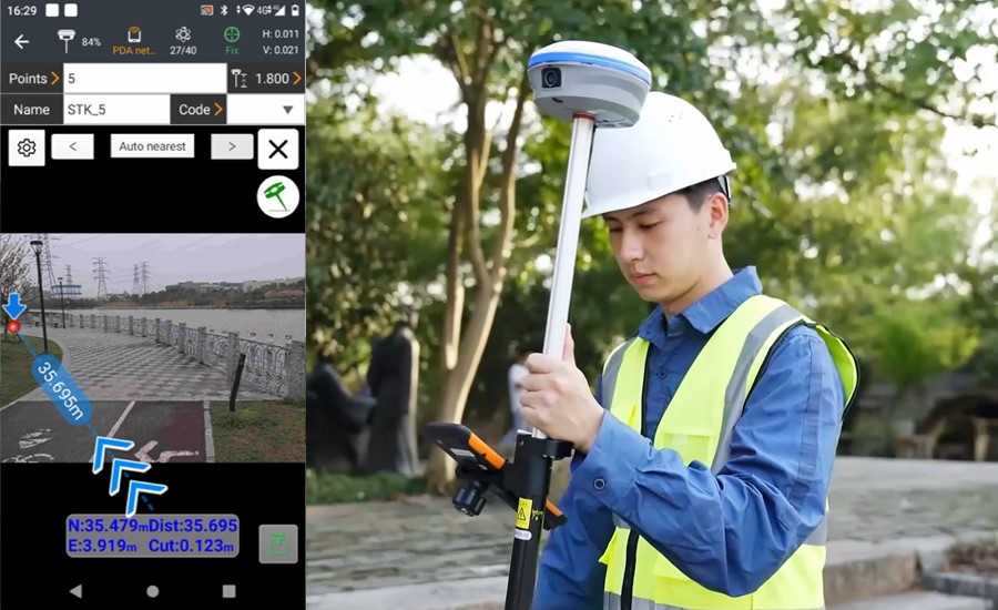
Figure 2. The i93 integrates star-level cameras to provide an immersive 3D visual navigation and stakeout experience.
- Real-time 3D visualization changes the face of surveying
The integrated Starlight cameras provide immersive 3D visual navigation. Based on powerful image processing technology, the cameras paired with the controller offer a unique way for surveyors to capture precise coordinates in real-time. Field operators simply follow the 3D directional arrow and distance on the controller in real-time to stake out points. The 3D visual guidance is also available for line and CAD map staking in LandStar™ software, making surveying easy, intuitive, and efficient.

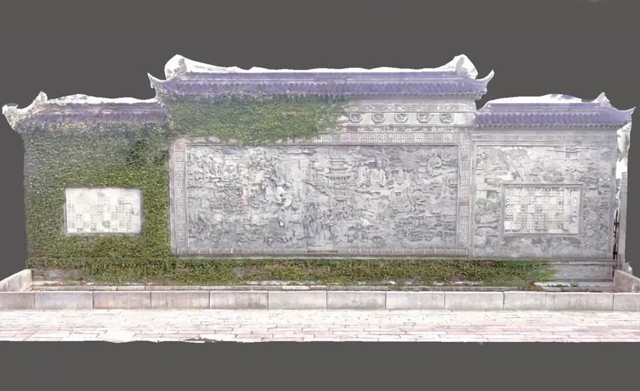
Figure 3. The 3D model of the cultural heritage object made in China with the help of the i93’s dynamic panoramic video capture and automatic image matching function.
- Auto-IMU for a seamless experience for all users
The Auto IMU feature eliminates the need for manual initialization and complex procedures. The CHCNAV's Auto-IMU 200 Hz pole-tilt compensation automatically maintains maximum accuracy, allowing the pole to be carried over the shoulder, held in hand, or placed horizontally, as you move from point to point on the job site. As a result, productivity is enhanced, and projects are completed in less time.
The i93 GNSS receiver is available worldwide through the CHCNAV Authorized Dealer network.
___
About CHCNAV
CHC Navigation (CHCNAV) creates innovative GNSS navigation and positioning solutions to make customers' work more efficient. CHCNAV products and solutions cover multiple industries such as geospatial, construction, agriculture and marine. With a presence across the globe, distributors in more than 120 countries and more than 1,600 employees, today CHC Navigation is recognized as one of the fastest-growing companies in geomatics technologies.
For more information about CHC Navigation [Huace:300627.SZ], please visit: https://www.chcnav.com/about-us/overview