CHCNAV RTK Rover used in the Northern Thailand Cave Rescue
All 12 members of a boy’s football team and their coach have been rescued after being trapped in the Tham Luang cave in Thailand for 18 days.

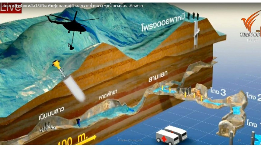
Volunteers offered their support to the Thai Navy using various survey technologies: drone mapping drone to find another entrance to the cave, drone thermal mapping by drone, ground survey to check a waterline to drain water from a cave, Lidar digital terrain mapping over the hill and GNSS RTK network to stake out the accurate position to drill a hole to assist all members in the cave.
In the mountainous terrain, the elevation measurement is a key prerequisite to compute the exact depth of the hole to drill to reach the rescue team. The thickness of the rock at this location (approximate depth around 500-600m) requires several days to complete the drilling.

The limited time and safety of lives were major reasons to consider the most suitable method to rescue them. Diving into the flooded cave was decided and involved volunteer divers and Thai Navy Seal.
CHC Navtech Thailand contributes to the rescue effort by providing GNSS RTK measurements down a centimeter level accuracy to accurately map the field of operation.