Deliver accuracy to your geospatial projects with CHC Navigation.
Learn More + Go to Geospatial2024-07-31
Shanghai, China – July 31, 2024 - CHC Navigation (CHCNAV), a global leader in geospatial technology solutions, announces the launch of the PS-2000, an innovative multi-point deformation monitoring system designed for high-precision slope stability and deformation analysis. Using advanced differential interferometry and circular synthetic aperture imaging techniques, the PS-2000 provides non-contact monitoring with sub-millimeter accuracy over a wide 360° range.
"The PS-2000 integrates the most advanced technologies in deformation monitoring. Its combination of high precision, wide coverage, and all-weather performance makes it an essential tool for professionals managing infrastructure stability and safety in challenging environments,” said Gavin Song, Product Manager at CHC Navigation.
High-Precision Monitoring in All-Weather
The PS-2000 uses advanced differential interferometry and circular synthetic aperture imaging techniques to achieve remarkable accuracy down to 0.1 mm for line-of-sight displacement. With a maximum operating range of up to 5000 meters, it provides comprehensive coverage for large-scale monitoring applications.
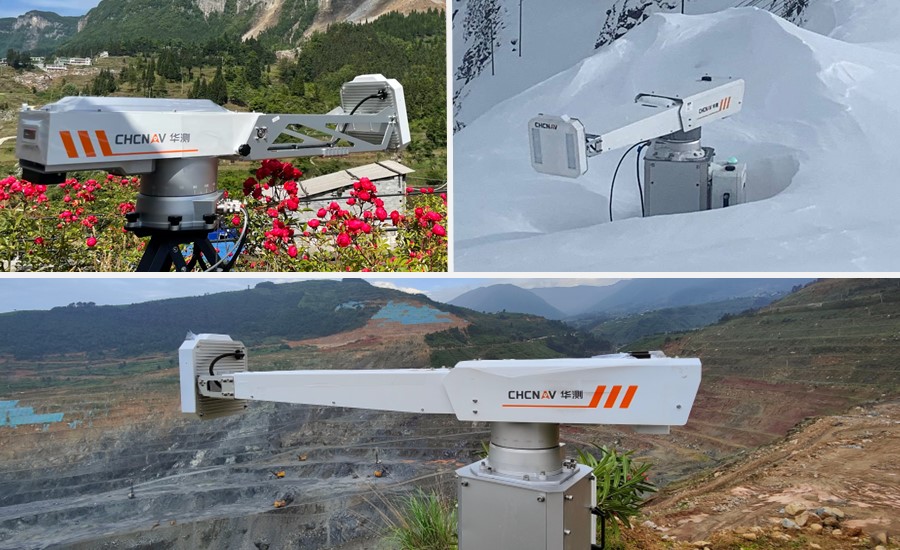
Designed to operate in harsh conditions, the PS-2000 features an IP65-rated construction that ensures resistance to natural environments. It maintains reliable performance in temperatures ranging from -35°C to +55°C and can withstand wind speeds of up to 100 km/h, ensuring continuous monitoring in a variety of environmental conditions.
PS-2000 Monitoring System: an advanced solution for slope stability and deformation monitoring.
Rapid Data Updates and Flexible Deployment
The PS-2000 provides real-time updates with the ability to scan 360° in just 120 seconds. Its compact design, weighing only 25 kg without stand, allows for quick and flexible deployment across multiple monitoring sites.
Versatile Applications
With its advanced capabilities, the PS-2000 is ideal for monitoring public and railroad embankments, open pit mines, tailings dams, landslides, and other geological hazards. Its non-contact measurement approach and wide coverage make it particularly suitable for areas where traditional monitoring methods are impractical or risky.
Comprehensive ecosystem
The PS-2000 can be combined with the H3 GNSS monitoring receiver and the MAS cloud monitoring data visualization and alarms platform to form a complete monitoring ecosystem. The MAS platform has comprehensive data fusion capabilities to combine monitoring data from multiple sources and provide different levels of alarms based on customized standards.
The PS-2000 Multi-Point Deformation Monitoring System represents a significant step forward in ensuring the safety and stability of critical infrastructure and natural formations, offering an unparalleled combination of accuracy, coverage and reliability.
____
About CHC Navigation
CHC Navigation (CHCNAV) creates innovative mapping, navigation, and positioning solutions to make customers' work more efficient. CHCNAV products and solutions cover multiple industries such as geospatial, construction, agriculture, and marine. With a presence across the globe, distributors in more than 120 countries, and more than 1,900 employees, today, CHC Navigation is recognized as one of the fastest-growing companies in geomatics technologies.
Have a question about our solutions or dealership opportunites