Deliver accuracy to your geospatial projects with CHC Navigation.
Learn More + Go to Geospatial2024-01-05
Shanghai, China – January 5, 2024 - CHC Navigation (CHCNAV), a leading global provider of GNSS technologies, is proud to announce the launch of its H3 GNSS monitoring receiver. The H3 integrates millimeter accuracy positioning, communications, and sensor technology in a single enclosure.
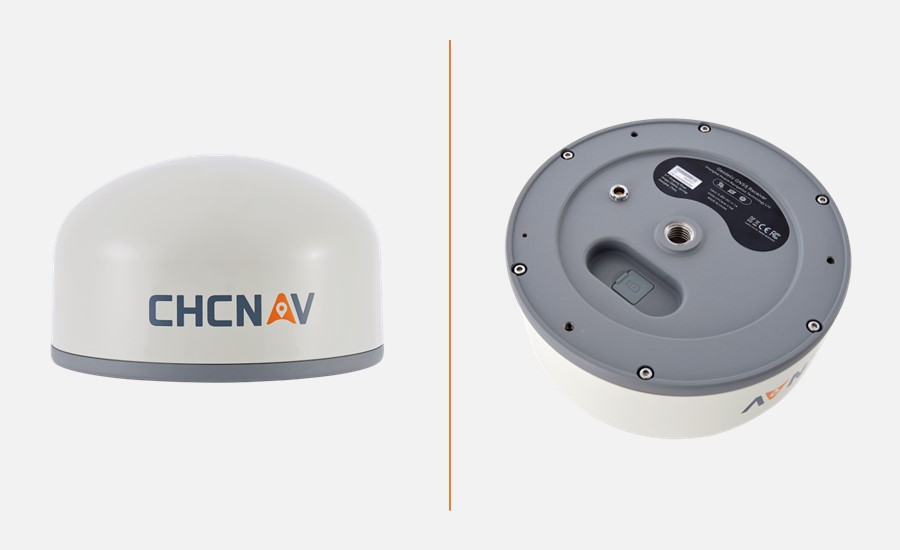
Figure 1. The H3 GNSS smart receiver designed for monitoring critical infrastructure.
The H3 leverages CHCNAV's extensive expertise in infrastructure monitoring to provide an efficient and reliable solution. Its integrated design incorporates a 1408-channel Geodetic-grade GNSS module, 4G modem, MEMS sensors, and rugged antenna in a compact form factor. The intelligent antenna technology ensures resilience in harsh environments while consistently delivering high-accuracy data. This versatile receiver simplifies deformation and subsidence monitoring for critical infrastructure.
"The H3 marks an exciting new chapter in our monitoring portfolio," said Gavin Song, a product manager at CHC Navigation. "With minimal setup requirements and rugged construction, users can easily install and rely on the H3 to provide accurate infrastructure data over time, regardless of environmental conditions, in industries such as construction, mining, and energy."
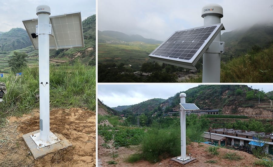
Figure 2. Deformation monitoring of landslide areas with the H3 GNSS receiver.
ALL-IN-ONE MONITORING SOLUTION
The H3 seamlessly combines a GNSS antenna and module, a high-end MEMS sensor, and a 4G modem into one integrated system. This eliminates the need for external components beyond a power supply, streamlining field installation. The built-in MEMS sensor provides additional tilt and vibration data for comprehensive monitoring.
RELIABLE POSITIONING IN HARSH ENVIRONMENTS
Leveraging 1408 GNSS channels and CHCNAV's patented iSTAR algorithm for robust satellite tracking, the H3 delivers millimeter-level 3D positioning accuracy. Its rugged, IP67-rated design withstands harsh outdoor environments, while its low power consumption enables long-term solar-powered operation.
TIMELY RESPONSE TO DEFORMATION
Utilizing high-end MEMS components and advanced variable frequency control technology, the H3 enables rapid data uploads when sudden ground deformation is detected. This feature is critical for providing immediate warnings and overcoming the limitations of long-term static GNSS monitoring.
CHCNAV's new H3 GNSS monitoring receiver provides an all-in-one solution for reliable, accurate, efficient deformation and subsidence monitoring for industries managing critical infrastructure.
____
About CHC Navigation
CHC Navigation (CHCNAV) creates innovative mapping, navigation, and positioning solutions to make customers' work more efficient. CHCNAV products and solutions cover multiple industries such as geospatial, construction, agriculture, and marine. With a presence across the globe, distributors in more than 120 countries, and more than 1,700 employees, CHC Navigation is recognized as one of the fastest-growing companies in geomatics technologies today.
Have a question about our solutions or dealership opportunites