Road surveying is a key component of infrastructure development and maintenance. As road management becomes increasingly digitized, traditional surveying methods face numerous challenges in terms of efficiency, accuracy and safety. The significant increase in data density and timeliness demands advanced solutions. High-resolution airborne LiDAR surveys address these needs by providing detailed, accurate data for asset extraction, maintenance planning, and database updates as road infrastructure changes.
- Asset Extraction: Accurate data is critical to identifying and cataloging assets such as signs, barriers, and utility poles along roadways. According to a study by the American Association of State Highway and Transportation Officials (AASHTO), accurate asset management can reduce maintenance costs by up to 20% annually.
- Preventive Maintenance: Precise, up-to-date information helps plan and execute maintenance activities to prevent infrastructure deterioration. The Federal Highway Administration (FHWA) reports that proactive maintenance can extend the life of road infrastructure by 25% to 30%.
- Database Maintenance: Regular updates ensure that the asset database reflects current conditions, preventing data obsolescence that can lead to inefficiencies and increased costs. Research from Geospatial World indicates that 15% to 25% of GIS data becomes outdated each year without regular updates, leading to potential errors and increased operational costs.
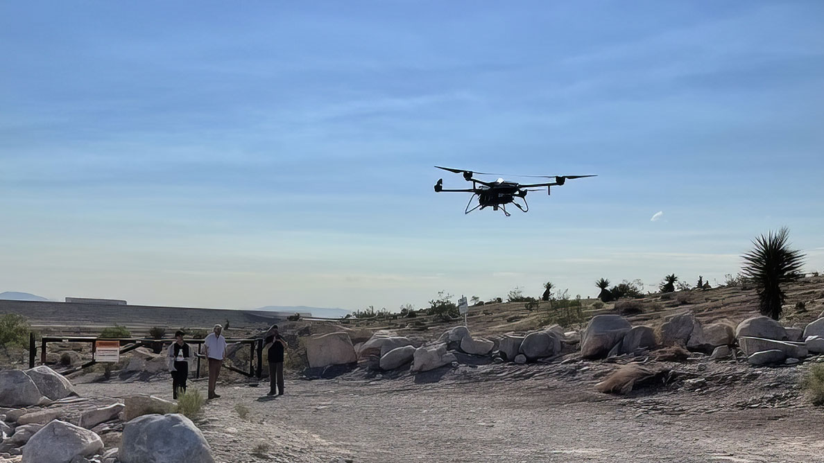
A CHCNAV BB4 Drone is taking off
In this newsletter, we explore how a complete airborne LiDAR ecosystem can accelerate the process of road surveying and look into the steps involved in conducting these surveys effectively.
What Roles Do Surveyors Play in Road Projects?
Surveying for road projects includes tasks necessary for the success and safety of road construction and maintenance. Surveyors accurately map terrain, generate cross sections and longitudinal profiles, and estimate earthwork volumes. Traditional methods, while effective to a point, often fall short in terms of operational efficiency.
The preliminary survey is the first phase of road construction surveying, designed to gather data for planning and decision making.
- Identifying Project Boundaries: Establishing the project’s extent and demarcating the area for detailed study.
- Evaluating Existing Road Networks: Assessing current road infrastructure if applicable.
- Assessing Terrain and Geographical Features: Understanding the landscape, including elevation, topography, and natural features.
- Gathering Initial Data: Collecting preliminary information to estimate project costs and timelines, which helps in feasibility studies and early decision-making.
During this phase, surveyors establish a traverse line along the proposed route, measure distances, and establish control points. They also conduct topographic surveys to collect elevation data and identify potential obstacles or environmental concerns.
After the preliminary survey and project design, a location survey is conducted to prepare for actual construction.
- Establishing the Final Center Line: Transferring the planned alignment to the field by establishing a precise center line along the route.
- Detailed Data Collection: Gathering comprehensive information on the terrain, soil composition, existing infrastructure, and environmental factors. This includes leveling work to determine elevations, drainage studies, soil surveys, and material availability assessments.
- Refining the Design: Using the collected data to finalize the road design, including horizontal and vertical alignments, cross-sections, and drainage plans. This phase ensures that all design elements align with the actual site conditions, minimizing discrepancies during construction.
What Are the Challenges with Conventional Surveying Techniques in Road Construction Projects?
Current methods of road surveying, including manual surveying and aerial photogrammetry, face several challenges that can affect efficiency, accuracy, and safety.
Ground based Surveying Methods uses GNSS RTK receivers, total stations, and other equipment to measure the spatial coordinates of physical objects. While accurate, it is labor intensive and time consuming due to some unique challenges:
- Large Workload: Manual surveying requires significant manpower and time, especially on large projects. Surveyors must physically measure numerous points, which can slow down the overall project schedule.
- Lower Efficiency: The need to manually set up equipment, take measurements, and record data reduces operational efficiency and is prone to human error, which can affect data accuracy.
- Operational Risk: Surveyors often work in hazardous conditions such as busy roads or rough terrain, increasing the risk of accidents and injuries during the survey process.
Aerial photogrammetry involves taking continuous photographs from an aircraft to create maps and 3D models of the area being surveyed. While this method can cover large areas quickly, it has several limitations:
- Need for Control Points: To ensure accuracy, aerial photogrammetry requires many ground control points. Setting up these control points is labor-intensive and can be a logistical challenge, especially in remote or hard-to-access areas.
- Extensive Post-Processing: The raw data collected from aerial imagery must be processed and analyzed, which is time-consuming and requires specialized software and expertise..
- Environmental Limitations: Weather conditions and lighting can significantly affect the quality of aerial imagery. Poor visibility, cloud cover, and shadows can obscure details and reduce the accuracy of the resulting data.
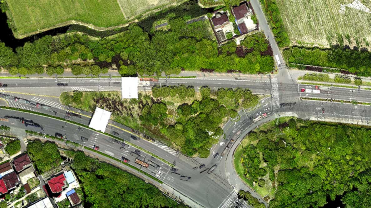
Construction area captured by CHCNAV AA10 system
How Airborne LiDAR Technology Can Transform Road Surveying
LiDAR technology is transforming road surveying by overcoming the limitations of traditional methods and introducing advanced capabilities that significantly improve efficiency, accuracy, and safety.
- Increased efficiency: LiDAR-equipped Unmanned Aerial Vehicles (UAVs) capture millions of precise data points per second, creating detailed 3D models of road corridors. This capability significantly outperforms traditional surveying techniques, allowing large areas and long linear projects to be covered quickly with fewer personnel. The use of UAVs reduces the time and labor costs associated with ground-based surveys, allowing surveyors to complete projects more efficiently.
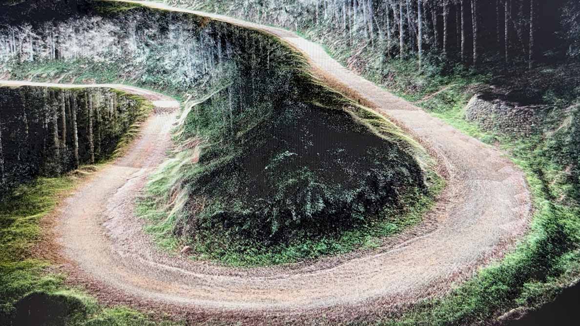
Road point clouds acquired from CHCNAV LiDAR
- Enriched data: LiDAR provides high-resolution data for more informed decision making. By generating highly accurate 3D models, LiDAR supports precise terrain modeling, cross section generation and volume calculations. The enriched data set is valuable for planning and designing road infrastructure by providing detailed insight into the topography and existing conditions of the surveyed area. LiDAR data is typically accurate to within a few centimeters, making it ideal for engineering surveys where precision is a must.
- Vegetation Penetration - One of the outstanding features of LiDAR technology is its ability to penetrate vegetation. Traditional photogrammetry can be hindered by dense foliage, making it difficult to obtain accurate ground topography data. LiDAR, however, uses laser pulses that can penetrate the canopy, reach the ground, and return detailed elevation data. Surveyors can therefore measure dense point clouds even in heavily forested areas, providing a clear picture of the ground topography beneath the vegetation.
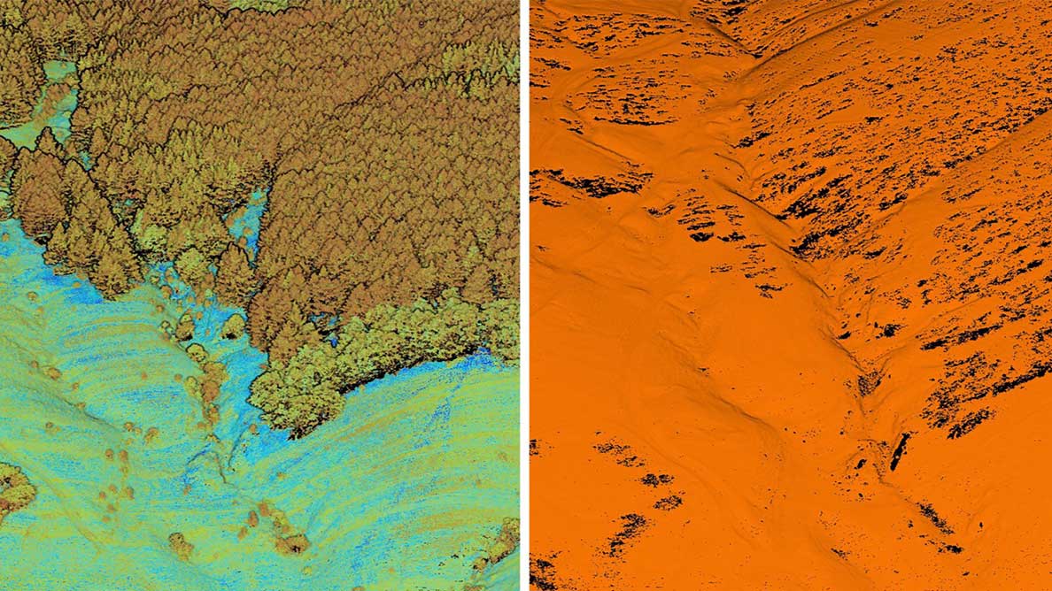
High-density ground point cloud under dense vegetation
- Improved safety: LiDAR technology improves surveyor safety by minimizing the need for human presence in hazardous areas. Traditional surveying often requires personnel to work near traffic, on unstable terrain, or in other dangerous environments. By using LiDAR-equipped UAVs, surveyors can conduct detailed surveys from a safe distance, reducing the risk of accidents and injuries.
Key Technical Specifications and Capabilities of an Airborne LiDAR System
LiDAR systems used for road surveying have several advanced features that enhance their performance, including:
- High Pulse Rate: Premium LiDAR systems can emit up to 2 million laser pulses per second, capturing dense point clouds with high spatial resolution for detailed data collection over large areas.
- Multiple Returns: LiDAR sensors can detect multiple returns from a single laser pulse, allowing them to capture data from different levels within the vegetation canopy as well as the ground surface, and create accurate Digital Terrain Models (DTMs).
- Long Range: Advanced LiDAR systems have a range of up to 1,800 meters and can operate at altitudes of up to 700 meters, making them ideal for corridor mapping and other large-scale survey projects.
- Real-Time Kinematic (RTK) and Post-Processing Kinematic (PPK) Corrections: These technologies improve the positional accuracy of UAV and LiDAR data, ensuring that collected data is accurate to within centimeters. RTK provides real-time corrections during data collection, while PPK allows for post-flight data corrections.

Clear Ground Information Acquired by CHCNAV LiDAR
Steps of Airborne LiDAR Road Surveying
The LiDAR measurement process involves multiple steps, from initial flight planning to final data processing. A robust ecosystem can streamline this process and provide actionable insights for road projects.
1. Flight Planning
Flight planning is the first step in the LiDAR-based road survey process and ensures that data collection is efficient and accurate.
- Software Applications such as CHCNAV's SmartGo or DJI Pilot 2 guide the UAV along a carefully planned flight path. Flight path design has a significant impact on data collection performance. Engineers plan the route using software that considers the LiDAR's field of view, scan distance, and desired point cloud density. Environmental factors, such as dense vegetation, may require additional scans to ensure sufficient ground point cloud information is collected.
- GNSS Correction: Accurate scanning results depend on the accuracy of the LiDAR, UAV positioning and data processing. Real-time kinematic (RTK) or post-processing kinematic (PPK) corrections can greatly improve positioning accuracy. For projects requiring high accuracy, using CHCNAV's iBase to provide RTK connectivity or using PPK ensures positioning accuracy.
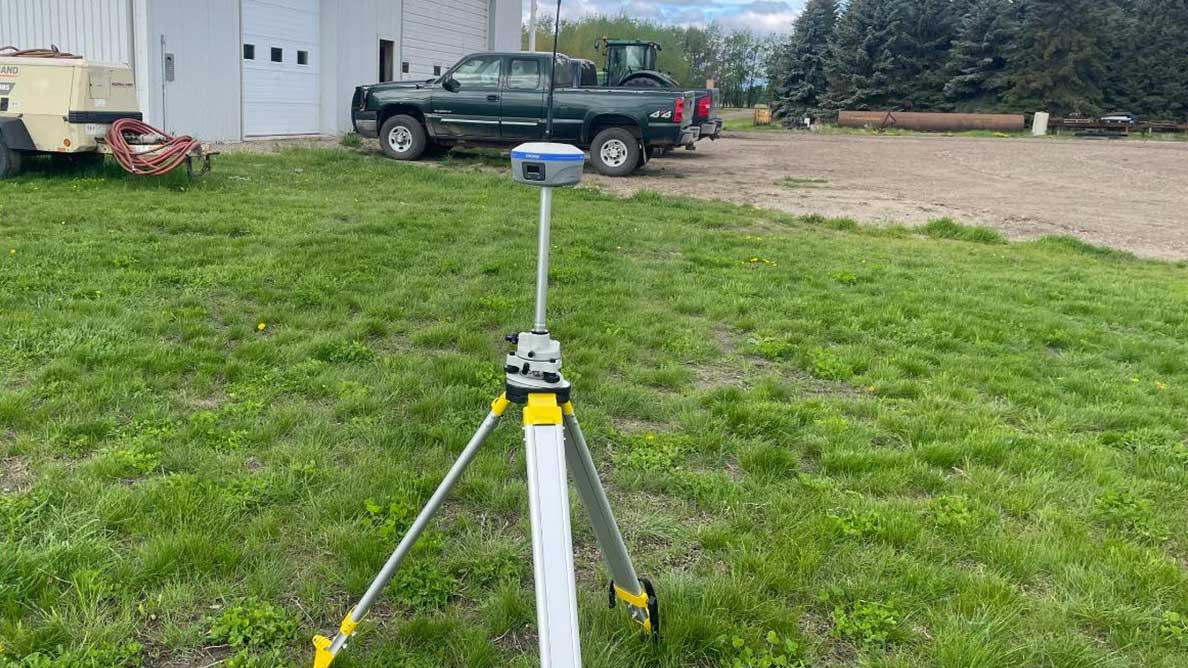
CHCNAV iBase
- Ground Control Points (GCPs): GNSS corrections allow high performance LiDAR to meet most accuracy requirements. For higher accuracy requirements, placing GCPs in the scanning area minimizes data processing errors. In road measurement zones, placing GCPs at pre-determined locations helps achieve optimal accuracy. For example, CHCNAV's AU20 LiDAR can achieve RMSE accuracy of 2 cm with a well-designed operation.
2. 3D Data Collection:
In the data collection phase, advanced LiDAR systems are used to capture detailed information about the road and its surroundings.
- Using a Premium LiDAR System such as CHCNAV's AlphaAir 15 (AA15), ensures high-density 3D data capture. It offers 16 returns per laser pulse across 7 multi-period zones for robust vegetation penetration, 2 million pulses per second at up to 600 lines per second for dense point clouds over large areas, and a maximum range of 1800 meters with an operating altitude of 700 meters, making it ideal for corridor mapping of infrastructure.
- Ensuring Real-time Monitoring to identify and mitigate potential problems such as lost RTK connections or unexpected interference. An adaptive approach ensures the highest quality of data collection, making sure no details are missed.
3. Data Processing
Data processing transforms raw LiDAR data into actionable insights. CHCNAV's CoPre and CoProcess software streamline this process through highly automated workflows.
- Automated Data Processing: CoPre software enables one-click processing of raw data, automatically generating point clouds and orthophotos without the need for manual intervention.
- Accuracy Improvement: Point cloud data accuracy can be enhanced in CoPre by importing control points to reduce absolute errors. Control points can also verify point cloud accuracy, and accuracy reports can be generated.
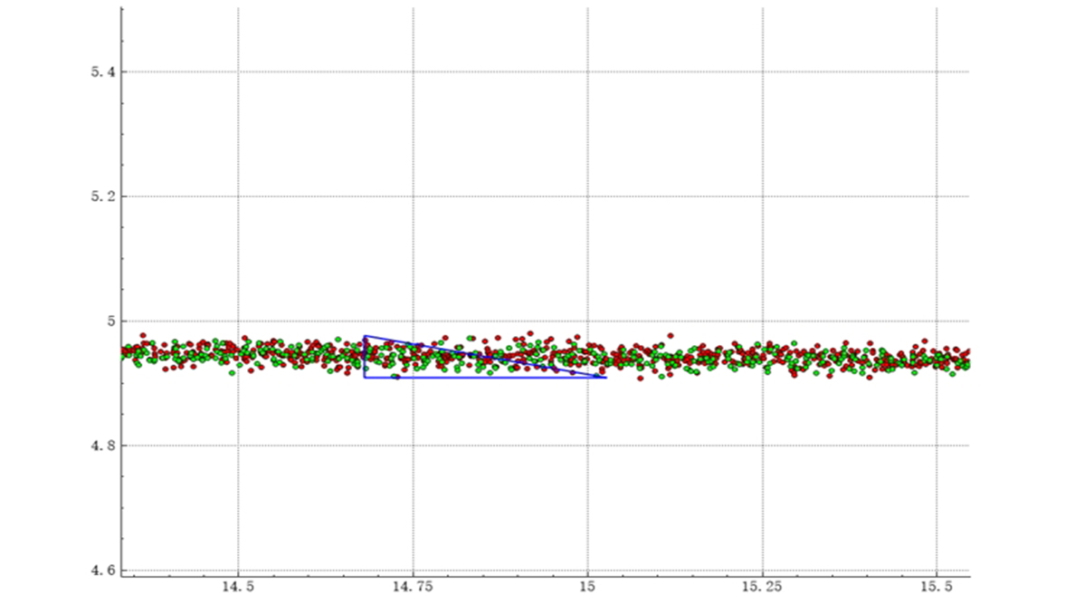
Point cloud thickness is 0.0353 meters
- Advanced Point Cloud Processing: CoProcess2.0 software provides tools for automatic ground point filtering, Digital Elevation Model (DEM) generation, and cross section extraction to speed the production of survey deliverables. Unlike traditional surveying, LiDAR point clouds provide richer ground detail, allowing CoProcess software to automatically generate cross sections from processed point clouds. Manual editing options are available for special terrain, such as roadside ditches, and sections can be exported to design formats or CAD drawings for immediate use.
- Specialized Functions for Road Surveying: CoProcess includes a road module divided into route analysis and road survey. Route analysis includes broken chainage calculation, horizontal curve calculation, and vector line to stake conversion. The road survey functions include cross section generation, section editing and display, and vector line editing.
- Road Feature Extraction: For existing roadway improvement projects, accurate extraction of roadway features increases the efficiency of subsequent design efforts. CoProcess' intelligent feature extraction module uses AI to track and extract dashed and solid lane lines with width and line type parameters with over 90% accuracy.
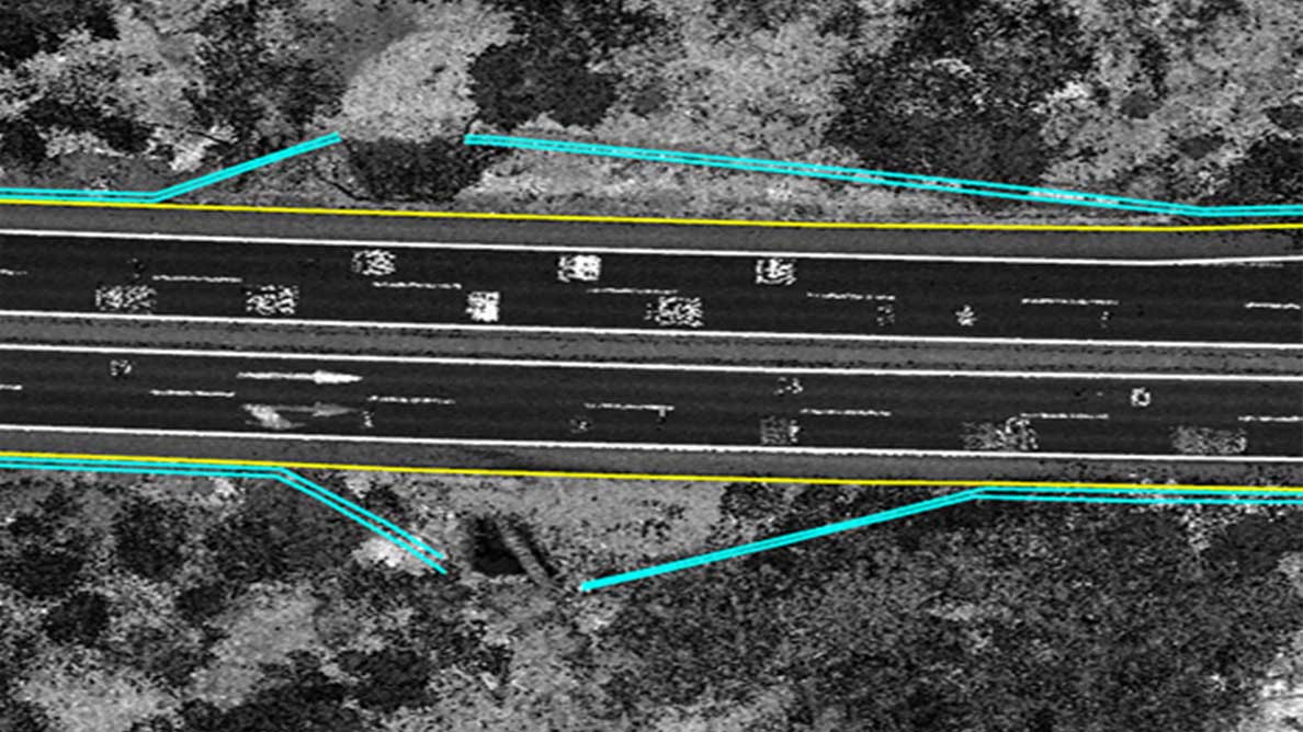
Highly automated road feature extraction
Empowering Road Infrastructure Development with Airborne LiDAR Technology
The integration of LiDAR technology into road survey operations represents a significant advancement in road infrastructure planning and development. Based on advanced LiDAR, GNSS, and IMU technologies, these cost-effective systems deliver precision and efficiency that were previously out of reach for many surveyors and engineers.
LiDAR technology is changing the way surveyors approach large-scale infrastructure projects. The high-density 3D data capture capabilities of systems like the AlphaAir 15 (AA15) enable comprehensive mapping of extensive road networks in a fraction of the time required by traditional methods. This is particularly beneficial for long linear projects, such as highways and major roads, where traditional surveying would be prohibitively time-consuming and expensive.
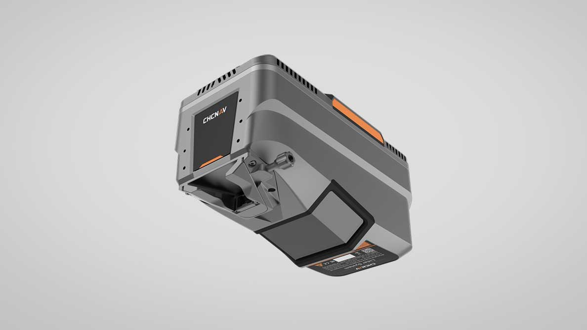
CHCNAV AA15 LiDAR
CHCNAV's LiDAR solutions, including the AlphaAir 15 and advanced software such as CoPre and CoProcess2.0, provide a comprehensive and efficient approach to road surveying. By providing high-resolution data, improved safety, and increased efficiency, these technologies enable geospatial and civil engineering professionals to effectively meet the demands of today's infrastructure. The use of LiDAR technology ensures that road surveying projects are conducted to the highest standards of accuracy and safety, leading the way to smarter and more sustainable infrastructure development.
____
About CHC Navigation
CHC Navigation (CHCNAV) develops advanced mapping, navigation and positioning solutions designed to increase productivity and efficiency. Serving industries such as geospatial, agriculture, construction and autonomy, CHCNAV delivers innovative technologies that empower professionals and drive industry advancement. With a global presence spanning over 130 countries and a team of more than 1,900 professionals, CHC Navigation is recognized as a leader in the geospatial industry and beyond.For more information about CHC Navigation [Huace:300627.SZ], please visit: www.chcnav.com
