The representation of archaeological heritage has undergone significant evolution in the past decade, thanks to the utilization of Unmanned Aerial Systems (UAS). The rapid development of these systems has made them invaluable tools for efficiently documenting large areas. Moreover, UAS are highly versatile and can be paired with various sensor types such as the visible spectrum, multispectral imaging, and LiDAR.
In this article, the authors present a case study involving the application of two UAS-embedded sensors, namely a camera and a LiDAR sensor, to document the archaeological area of the Espique Valley in La Peza, Granada. The study focuses on analyzing the advantages and disadvantages associated with these sensors.
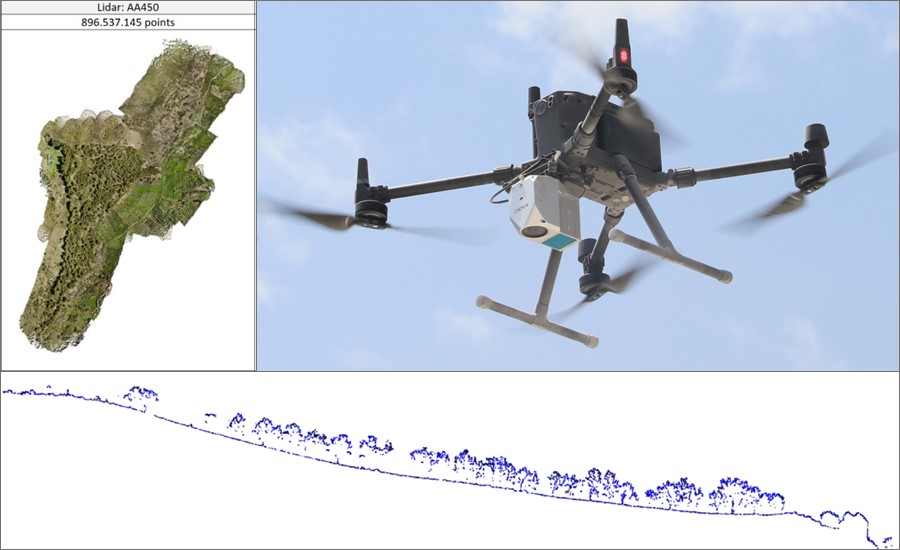
Initially, a photogrammetric survey was conducted using a DJI Phantom 4 Pro. Ground control points, acquired through a GNSS system, were used to georeference the survey. Subsequently, the same area was surveyed using a DJI Matrix 300 equipped with a CHCNAV AA450 LiDAR sensor as the payload. While previous literature has explored the potential of both techniques, the emphasis has predominantly been on LiDAR systems with limited coverage. However, in recent years, these types of sensors have undergone significant advancements, leading to their wider adoption in the field of archaeology.

Figure 1. From left to right, top to bottom: AA450 LiDAR’s point cloud; DJIM300 RTK and AA450 LiDAR; point cloud of the vegetation.*
The research results demonstrate the practicality of both systems in efficiently characterizing large areas with excellent geometric and topographic accuracy. However, the LiDAR survey demonstrated its superior effectiveness in densely vegetated areas, which are challenging for photogrammetric surveys. However, conducting a LiDAR survey with a high density of points per square meter requires the application of automatic or semi-automatic classification algorithms. Ultimately, these two techniques complement each other and represent a significant advancement in the high-quality documentation of cultural heritage.
Full Text: The documentation of archaeological heritage through aerial photogrammetry and UAS-based LiDAR: the case study of the Espique valley (La Peza, Spain)
Source: DISEGNARECON Journal - https://disegnarecon.univaq.it/ojs/index.php/disegnarecon/article/view/1045
Copyright: Jesús María Rodríguez Bulmes, José Antonio Benavides López, Pablo Romero Pellitero, José María Martín Civantos, Jorge Rouco Collazo.
Notes: The abstract on this page was slightly rephrased and image combined from the images used in the case study.
___
About CHCNAV
CHC Navigation (CHCNAV) creates innovative GNSS navigation and positioning solutions to make customers' work more efficient. CHCNAV products and solutions cover multiple industries such as geospatial, construction, agriculture and marine. With a presence across the globe, distributors in more than 120 countries and more than 1,600 employees, today CHC Navigation is recognized as one of the fastest-growing companies in geomatics technologies.


